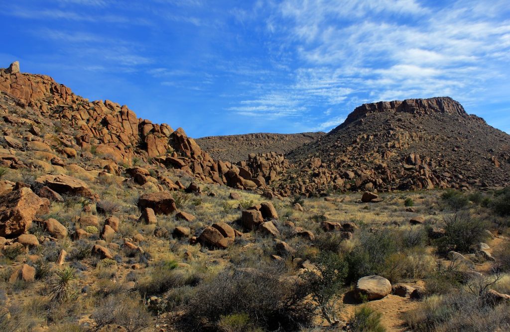
Big Bend National Park, located in Texas, is a special place full of amazing desert views, deep canyons, and towering mountains. Whether you want to climb a tough mountain or enjoy a peaceful walk through a canyon, Big Bend has it all. Here are eight of the best hikes that show off the park’s beautiful and unique scenery.
1. Lost Mine Trail
Trail Map
The Lost Mine Trail is a popular hike in Big Bend that’s moderately challenging but fun! Along the way, you’ll get to see amazing views of the Chisos Mountains and the desert below. The trail goes uphill, but it’s not too hard to handle, and the view at the top is totally worth it.
Make sure to start early because there’s not much shade, and the parking lot fills up fast. This hike is perfect if you’re looking for a cool adventure that takes about half a day.
Distance: 4.8 miles (round trip)
Elevation Gain: 1,100 feet
Difficulty: Moderate
2. The Window Trail
Trail Map
The Window Trail is a famous hike in Big Bend that takes you through the beautiful Chisos Basin. At the end of the trail, there’s a “window” in the rock where you can see the desert spread out in front of you. Along the way, you’ll enjoy amazing views of cliffs and greenery.
Be careful near the end because the rocks can get slippery. This trail is perfect for anyone who loves taking cool photos, especially of sunsets!
Distance: 5.6 miles (round trip)
Elevation Gain: 980 feet
Difficulty: Moderate
3. Santa Elena Canyon Trail
Trail Map
The Santa Elena Canyon Trail is one of the most beautiful hikes in Big Bend. It takes you right into a giant canyon carved by the Rio Grande River. This is an easy, short walk with hardly any uphill climbing, so it’s great for families or anyone who wants a relaxing hike.
The tall canyon walls and the river below make for incredible views all along the way!
Distance: 1.7 miles (round trip)
Elevation Gain: Minimal
Difficulty: Easy
4. Emory Peak Trail
Trail Map
If you’re looking for a tough hike, the Emory Peak Trail is perfect! It’s the highest point in Big Bend and gives you amazing 360-degree views of the whole park. The trail starts in the Chisos Basin and goes up through forests of pine and oak trees.
Near the top, there’s a steep rock climb that can be tricky. This hike is challenging but totally worth it for experienced hikers!
Distance: 10.5 miles (round trip)
Elevation Gain: 2,400 feet
Difficulty: Strenuous
5. Balanced Rock via Grapevine Hills Trail
Trail Map
This short hike is a cool adventure with amazing rock formations! The trail is mostly flat, but near the end, you’ll need to do a little bit of climbing to reach the famous Balanced Rock, a huge boulder resting between two other rocks. Most hikers can handle this trail, and it’s a great spot to take some awesome photos!
Distance: 2.2 miles (round trip)
Elevation Gain: 240 feet
Difficulty: Easy to Moderate
6. South Rim Trail Loop
Trail Map
The South Rim Trail Loop is known as one of the top hikes in Texas. It’s a tough hike that takes you through different environments, from dry desert plants to forests high up in the mountains. When you reach the rim, you’ll get amazing views of the desert stretching all the way into Mexico.
This trail is great for experienced hikers and can take a full day or be done overnight for those who want to explore Big Bend’s wild beauty!
Distance: 12-15 miles (depending on route)
Elevation Gain: 2,000 feet
Difficulty: Strenuous
7. Emory Peak via South Rim Trail and Boot Springs Trail
Trail Map
The hike combining the South Rim Trail and Boot Springs Trail takes you all the way to the top of Emory Peak. It’s longer and more challenging than the direct Emory Peak Trail but gives you even more amazing views and a chance to see wildlife. This hike is best for experienced hikers who have the energy to handle tough climbs and long distances!
Distance: 12.5 miles (round trip)
Elevation Gain: 3,000 feet
Difficulty: Strenuous
8. Basin Loop Trail
Trail Map
The Basin Loop Trail is a great option if you want to explore the Chisos Basin but don’t have time for a long hike. This easy trail gives you beautiful views of the nearby mountains and the green plants around you. It’s perfect for a quick walk or as a warm-up before trying harder trails in the park. Even though it’s short, the views are still amazing!
Distance: 1.8 miles (round trip)
Elevation Gain: 350 feet
Difficulty: Easy
9. Boquillas Canyon Trail
Trail Map
The Boquillas Canyon Trail is a short but beautiful hike that takes you along the Rio Grande into the calm Boquillas Canyon. The high cliffs make you feel like you’re in a special, grand place. This trail is great for a relaxing hike with lovely views of the river and the desert. Watch for wildlife and listen for cool echoes bouncing off the canyon walls!
Distance: 1.4 miles (round trip)
Elevation Gain: Minimal
Difficulty: Easy
10. Pinnacles Trail
Trail Map
The Pinnacles Trail is the starting point for some of the toughest and most rewarding hikes in Big Bend, like Emory Peak and the South Rim. It begins in the Chisos Basin and goes up through forested switchbacks, giving you great views of the nearby peaks.
It’s a hard climb, but the amazing scenery and chances to spot wildlife make it worth the effort. If you’re heading to Emory Peak or the South Rim, the Pinnacles Trail is an important part of your adventure!
Distance: 4.8 miles (one way)
Elevation Gain: 1,500 feet
Difficulty: Strenuous